 logo

Geographic Information Systems, or GIS Mapping, changed everything about how we collect, save, and look at information tied to specific places. Lots of jobs rely on GIS mapping. Think about building a new town or keeping wild areas safe—it’s a big help.

Ever wonder what goes into GIS mapping and what it can do? We’ll show you its building blocks and how it’s used, proving its huge importance. Understanding what is GIS mapping becomes much easier when you know the right components and real-world applications.
Understanding GIS mapping
GIS mapping is a powerful technology that combines spatial data—such as geographic coordinates, terrain, and environmental features—with other relevant information like demographic data, infrastructure details, and land use patterns. By creating detailed visual representations, or maps, it allows users to analyze the geographic relationships and trends within an area. Understanding a location thoroughly involves integrating all these diverse data points, which enhances decision-making and problem-solving capabilities. GIS mapping is widely used in urban planning, environmental management, disaster response, transportation, and resource management, helping professionals plan more effectively and respond efficiently to various challenges.
Core components of GIS
To understand how GIS mapping works effectively, let’s break down the four main components that make it all possible.
- Hardware – The physical devices form the backbone of GIS mapping. Computers, servers, and GPS units are absolutely necessary. Imagine handling huge piles of information with ease. These programs allow you to retrieve, sort, and modify all that data as needed.
- Software – GIS software is the engine that drives the system. From collecting all your facts to understanding them and then showing them off, this tool handles it all. You’ll use these apps to draw up custom maps, figure out spatial patterns, and keep your data perfectly organized.
- Data – High-quality data is crucial for accurate mapping. Spatial data includes coordinates and geographical features. Attribute data adds details such as demographics, land use, and environmental factors. Together, they create a detailed picture of an area.
- People – GIS really shines when trained experts are behind the controls. They make sure all that map data actually gets used well. Analysts, developers, and technicians all join forces. This keeps the system running. You can count on them to understand information. They then pick the best paths.

Applications of GIS mapping
Now that you know what makes GIS tick, let’s look at how people actually use this technology in the real world.
Market analysis and site selection
The old saying about retail goes something like this: “location, location, location”. And, that couldn’t be more true. GIS eliminates the tedious and time-consuming process of manually mapping traffic patterns. GIS data allows you to find the optimal location for your branch, store, or development by comparing spatial data with demographics, competitive analysis, and accessibility. Armed with this data that includes income levels, population density, and other market factors, you’re in a position to make informed decisions about where to locate your business optimally.
Customer segmentation and targeting
Geographical segmentation makes your marketing more effective, involving less wasted efforts and improving performance. GIS systems allow you to visualize the distribution of customers and potential customers geographically so you can tailor your advertising and marketing efforts to the segments located in a particular region. This is especially valuable when you consider direct mail campaigns and local digital advertising to ensure you match your messaging to segments in an area.
Supply chain and logistical optimization
Logistics is a huge part of the expense involved in distributing physical products, especially as e-commerce increases costs by replacing bulk delivery of products to retailers with much more expensive home/ office delivery. This increases the need for route efficiency to optimize routes, thereby reducing the costs of fuel, wear on delivery vehicles, and driver wages.
In terms of supply chain management, you need facilities located near consumers to reduce delivery time as more consumers demand same-day or next-day delivery of items ordered online. Optimizing supply chains requires warehouses located near where your customers live, with access to logistics services such as rail and air, and fleet planning that ensures you know the exact location of each vehicle. Locating your vehicles in physical space helps reduce delivery delays by routing trucks to avoid congestion or construction, or re-routing critical deliveries when you anticipate a delay.

Urban planning
GIS (Geographic Information Systems) mapping is a crucial tool in the design and management of urban spaces. It helps planners analyze various factors such as traffic flow, land use, population distribution, and environmental conditions. By leveraging this information, urban developers can improve transportation systems, optimize land use, and create sustainable, environmentally friendly communities. Overall, GIS mapping facilitates data-driven decision-making to develop more efficient and livable cities.
Environmental conservation
Protecting natural resources is one of the primary applications of Geographic Information Systems (GIS). GIS allows conservationists, environmentalists, and government agencies to create detailed maps of animal habitats and migration routes. By tracking these patterns, experts can identify critical areas that require protection or restoration. This technology also enables efficient management of natural resources by analyzing spatial data related to forests, water bodies, wildlife populations, and pollution sources. According to the U.S. Environmental Protection Agency, GIS technology is indispensable for environmental monitoring, disaster response, resource management, and policy planning efforts, helping to develop data-driven strategies for sustainability and conservation.
Disaster management
In emergency situations, Geographic Information System (GIS) mapping plays a vital role by offering detailed spatial insights. It allows responders to accurately identify vulnerable areas such as flood zones, earthquake-prone regions, or wildfire risks. By analyzing historical data and current conditions, GIS helps in planning efficient evacuation routes and resource deployment. Organizations often review past incidents’ data to evaluate what mitigation strategies were effective and which areas need improvement. This comprehensive approach enhances preparedness and resilience, ultimately reducing the impact of disasters on communities.
Agriculture
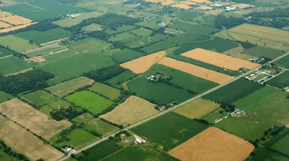
Farmers and large agricultural companies increasingly use Geographic Information System (GIS) maps to optimize crop production and improve efficiency. Farmers who understand their soil composition, monitor weather conditions, and regularly inspect their crops can make smarter decisions about planting and resource use. which is especially important for water conservation and to reduce the use of pesticides. By leveraging GIS technology, they can maximize yield per acre while reducing the use of water, fertilizers, and pesticides. This approach leads to more sustainable farming practices and higher productivity.
Public health
Health professionals utilize Geographic Information Systems (GIS) to monitor and analyze the spread of disease outbreaks in different regions. By mapping the distribution of illnesses and health data, they can identify hotspots and assess the specific needs of various communities. This targeted approach allows them to efficiently allocate medical supplies, deploy health interventions, and respond swiftly to emerging public health threats, ultimately improving the effectiveness of outbreak containment and health support.
Tourism and event planning
Major attractions want to efficiently manage traffic flow to reduce wait times at popular rides. Disney even utilizes GIS mapping to manage its demand pricing system, which optimizes revenue. Parks use these systems to lay out walking paths and amenities in a way that better serves visitors. You can do the same type of planning to manage events by mapping access routes, facilities, and services.
Challenges and considerations
While GIS mapping offers numerous benefits, it also presents challenges. Getting your facts straight matters, or your conclusions will be way off. Safeguarding confidential records remains paramount. Think of health data; its protection is absolute. The cost of hardware and software can be prohibitive for some organizations.
Future prospects
The outlook for geographic information systems (GIS) remains highly optimistic due to ongoing advancements in digital infrastructure. These breakthroughs continually expand GIS capabilities, enabling more comprehensive spatial data analysis. The integration of artificial intelligence (AI) with remote sensing technologies significantly enhances data processing efficiency, allowing for faster, more accurate insights and improved visualization of complex datasets.
Conclusion
Connecting information to solid plans becomes easy with GIS mapping. Every piece works in sync. This provides crucial information across countless areas. Picture this: GIS will become incredibly powerful as technology advances. It’ll spark countless new ideas and give us better ways to fix things. Imagine how much clearer things would be if you used GIS mapping. You’d make smarter choices, seeing exactly what’s going on around you.
Need marketing help to support business growth?
We welcome the opportunity to show you how we can make your marketing SIZZLE with our data-driven, results-oriented marketing strategies. Sign up for our FREE newsletter, get our FREE guide to creating an awesome website, or contact us for more information on hiring us.
Hausman and Associates, the publisher of MKT Maven, is a full-service marketing agency operating at the intersection of marketing and digital media. Check out our full range of services.
Discover more from MKT Maven
Subscribe to get the latest posts sent to your email.


